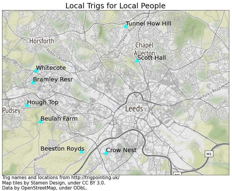
The eight trig points within 5 km of my house
A wander around the Trigpointing UK site revealed that there were eight trig pillars within the arbitrary 5 km radius I set upon, and I came up with a fairly logical route round them. One of my housemates showed mirth in my direction when I revealed that such a website existed, though I wasn't accused of being too much of a nerd by revealing that I don't have an account on the site, so can't and won't log my visits. Reading the logs was useful, however, as it meant I could guess which trigs were accessible and which weren't. As it turns out, four of the eight were somewhat inaccessible for all but the ardent pillar hunter, due to their locations in a school playground, in a scrappy farmyard and behind a reservoir fence. There was also one next to an abandoned cemetery with friendly "trespassers will be prosecuted" signs at the start of the access track. The other four were on public land, pretty much. Out of the four inaccessible trigs, the one I decided I had the most chance of touching was the cemetery one, and it wasn't visible from a road or public path like the other three "inaccessible" ones. Good thing that the law making intentional trespass a criminal offence doesn't come in yet.
The order that came to mind was Home - Crow Nest - Beeston Royds - Beulah Farm - Hough Top - Bramley Resevoir - Whitecote - Tunnel How Hill - Scott Hall - Home.
I was originally undecided whether to go clockwise or anticlockwise, the benefits of a clockwise round being I got the fair bit of grim tarmac running along the gyratory out the way early on, and I could get past Elland Road before it got too busy.
Additionally, I conjectured that the cemetery by Beeston Royds was unlikely to be busy earlier on in the day so I was less likely to be challenged there.
There was also the benefit of finishing on familiar territory at Tunnel How Hill and Scott Hall: the Meanwood Valley Trail is my go to stomping ground, and I was familiar with the trigs thanks to the excellent 3 Trigs Challenge.
I settled on clockwise which I was pleased with once I reached Post Hill - more on that later.

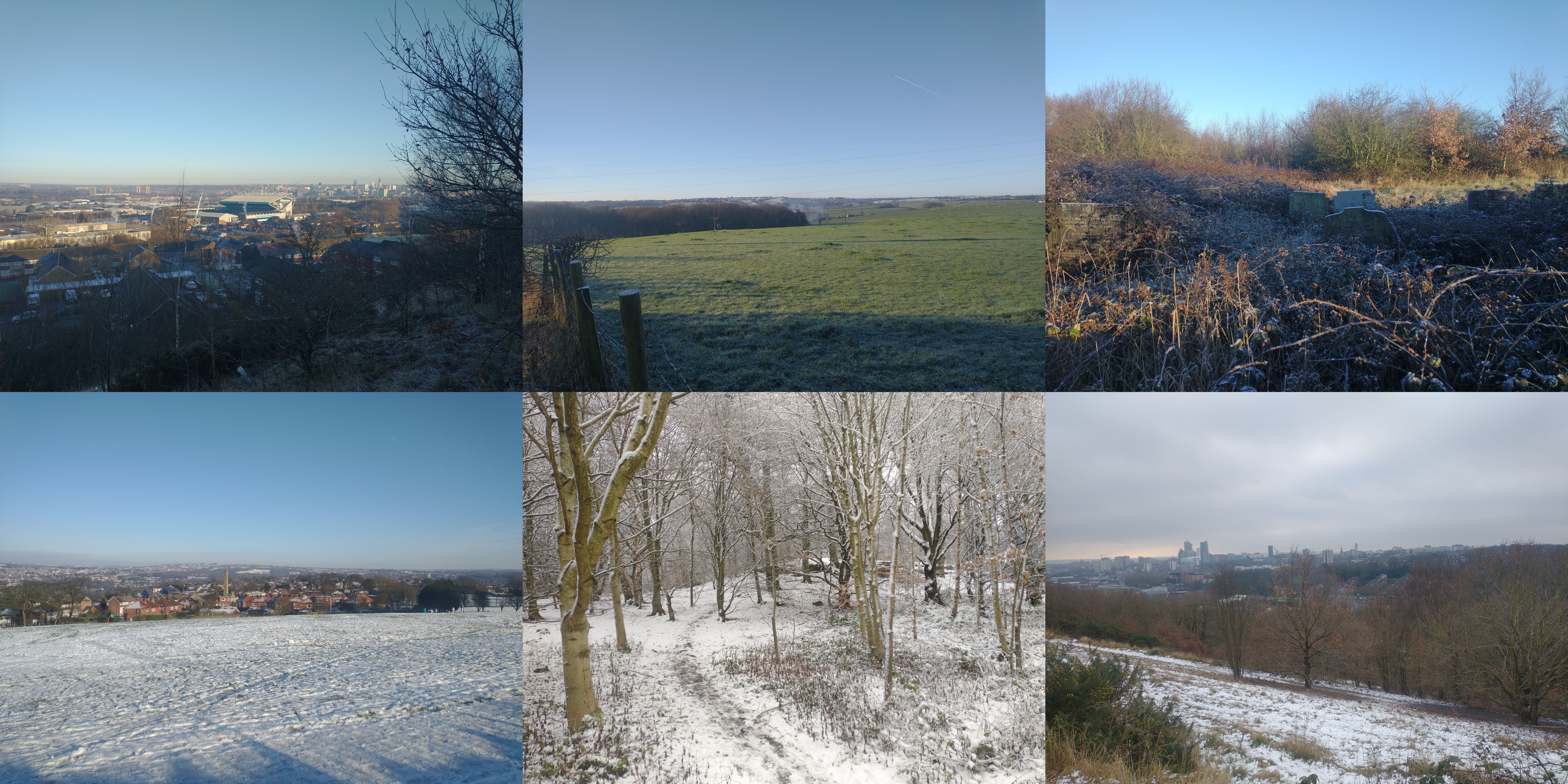
Saturday 9th was a bit icy underfoot, and there were patches of snow leftover from Friday's snow showers. On the whole temperatures were on the warmer side of 0°C and I didn't have much trouble with icy pavements setting off. Conditions were nice and clear and since I'd properly planned the section from my house up to Crow Nest, I soon found myself jogging past Leeds United and up the road past the police station. The path I'd planned to pickup alongside some houses took me up a hill, and the edge of a school, so the trig was located somewhere nearby. The path round the school took me right past the trig so I managed to stick my phone through the fence to get a picture. There were some great views northwards over Leeds. Lovely.
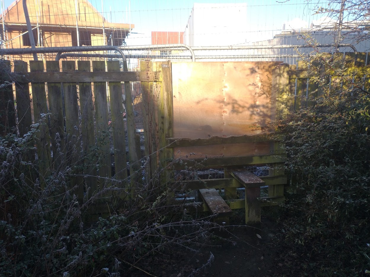
From here I hadn't meticulously planned my route, but with a couple of checks on the OS maps app, I made my way over a playing field and through a housing estate to Cottingley station. So far, so good. The pavements in the housing estate on the other side of the railways were icy underfoot, and the path I (eventually) found which I had planned to follow was blocked due to new houses, which was frustrating. I eventually made my way onto a track around the building site which brought me back on track and under the motorway. Once I'd picked up the road I picked an opportune moment with not too much traffic passing to head up the access track past the cemetery. The trig was soon found languishing at the edge of some trees and I stopped to take a couple of photos before retracing my steps down to the road, stopping once to peer over the wall at some of the gravestones. It's a shame that the cemetery has been left to nature in this way, but understandable given its location on the site of a coal mine and the resulting subsidence meant it was unsafe for the public to enter.

I munched some pork pies on the road. The first proper off road section proper beckoned, and I made my way up through a muddy field of horses towards Farnley, OS map firmly in hand now. This passed without incident; there were a few sections with slippy flagstones, but these were avoidable. I made it out to the road by the Beulah Farm trig, which was located by a pub with a police van in the car park (the first of a few police cars out and about today). I glimpsed the trig in the farmyard from the road - that was enough for me - and retraced my steps to the footpath into Post Hill Woods. I've not been in these woods before, and I need to revisit! The run downhill was enjoyable (if I'd gone anticlockwise I'd have had to go up it which would've been a bit of a pull up), and I picked up a path on the west side of the beck thanks to some non-slippy stepping stones. I made it out onto the road to make my way up to the worse-for-wear Hough Top trig and a road plod down past Bramley station. Having ticked off half of my trigs I was feeling pretty good. Bramley Park arrived and was busy with folk sledging and enjoying the snow on their exercise. I stopped to chat with a lady who complimented my mapcase and I explained what I was doing - a friend of hers bags trig points so when I pointed out the one behind the fence she said she hadn't spotted that before and would send a photo of it to her friend. The next trig is an intriguing one, with its location being in someone's front garden so definitely wins the award for best-kept for the day. I'd cycled past it before during the first lockdown when you could go for a bike ride and see 8 cars in total. Halcyon days.

The Eight Trigs (L-R, Top to bottom: Crow Nest; Beeston Royds; Beulah Farm; Hough Top; Bramley Resr; Whitecote; Tunnel How Hill; Scott Hall; Intact OS plug)
With that bagged there was an enjoyable stretch down through Bramley Fall - somewhere I need to have a proper explore one day - I've ran through a few times but don't know it all too well. My choice of path was worthy and I arrived at the locks with a handy footbridge over the canal. I was on familiar territory now as I made my way through Kirkstall Forge station and put my map back into my running vest. A slow stretch through the woods and up Butcher Hill left me in need of Jelly Babies which were consumed before I headed down through the Hollies (a cracking set of woods) and up on the other side of a busy Meanwood Valley Trail to Tunnel How Hill. I almost stacked it on the path up to the trig but regained composure and soon had it bagged. The woods were particularly snowy which made for some nice pictures. The next stretch to Scott Hall had been recced previously so I knew it well and soon had the final trig bagged in the central reservation of Scott Hall Road. Why it's in the central reservation (and has survived this long) still remains a mystery. The last hill up Woodhouse Ridge passed at a walk and I jogged over Woodhouse Moor and back home for some beans on toast.

Some views from the day
All in all, a fun half-day's outing round some parts of Leeds I hadn't explored.